Annapurna, Nepal Posted on March 30, 2012August 16, 2017 by Beautiful Places to Visit See more pictures of Annapurna, Nepal
Torres del Paine National Park, Patagonia, Chile Posted on November 9, 2011August 16, 2017 by Beautiful Places to Visit See more pictures of Torres del Paine National Park, Patagonia, Chile
Mount Fuji, Japan Posted on August 3, 2011August 15, 2017 by Beautiful Places to Visit See more pictures of Mount Fuji, Japan
Matterhorn, Switzerland Posted on June 22, 2011August 18, 2017 by Beautiful Places to Visit See more pictures of Matterhorn, Switzerland
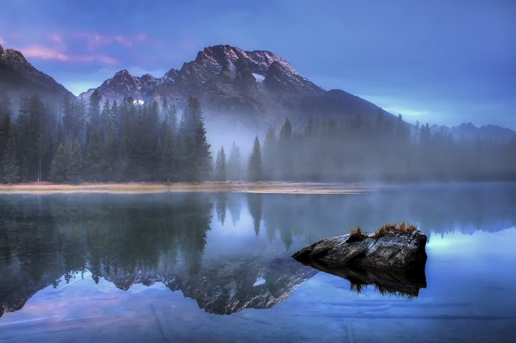
Grand Teton National Park, Wyoming Posted on April 12, 2011August 16, 2017 by Beautiful Places to Visit See more pictures of Grand Teton National Park, Wyoming
Wind River Range, Wyoming, USA Posted on April 11, 2011August 16, 2017 by Beautiful Places to Visit See more pictures of Wind River Range, Wyoming, USA
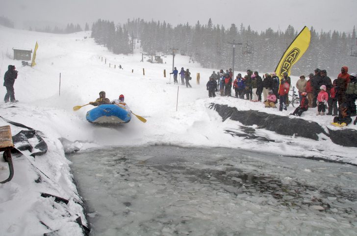
Monarch Ski Resort, Colorado Posted on December 3, 2010August 16, 2017 by Beautiful Places to Visit See more pictures of Monarch Ski Resort, Colorado
Mount Taranaki, New Zealand Posted on September 2, 2010August 16, 2017 by Beautiful Places to Visit See more pictures of Mount Taranaki, New Zealand